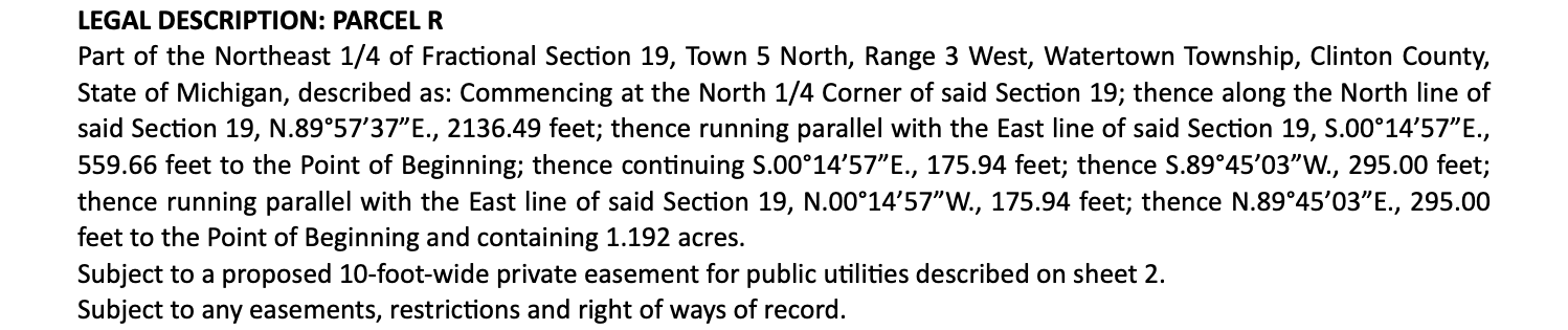
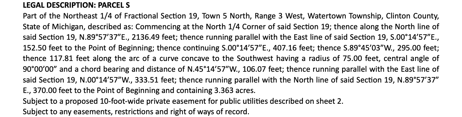
A legal description is not really a paragraph. It is a set of walking directions. Somebody stood at a corner, turned to face a direction, walked a measured distance, and wrote down what they did. Then they did it again, and again, until they got back where they started.
Once you read a deed that way, the wall of abbreviations stops being intimidating. Key terms are linked to their definitions as they come up, and everything this post uses is defined again at the bottom.
Where the Walk Starts
Most descriptions open with text you can safely set aside. In a PLSS state, it ties to a section corner or an aliquot part so a reader can find the general neighborhood. That opening route is a commencement, not part of the boundary.
The boundary itself begins at the point of beginning. Everything before it just gets you to the gate. Everything after it is the fence.
Reading a Single Call
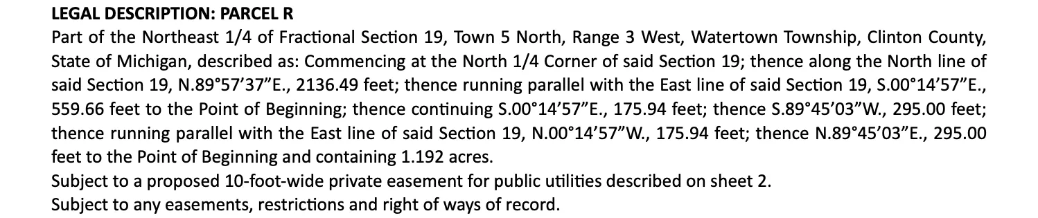
That is a whole parcel — six calls and an acreage — in one paragraph. Here is a single call out of it:
thence N 89°57’37” E, 2136.49 feet
Three pieces of information are packed into that line.
The Direction
The first part is a bearing. It reads as an angle turned off of north, toward the east. Bearings are always written in degrees, minutes, seconds — sixty minutes to a degree, sixty seconds to a minute. A bearing angle never exceeds 90°, because the leading and trailing letters already tell you which quadrant you are in.
Plotting software does not think in quadrants. It converts each bearing to an azimuth, a single clockwise angle from north, before doing any arithmetic.
The Distance
The second part is how far to go. Modern deeds use decimal feet. Older ones use a chain, a rod, or in parts of the Southwest a vara, and those have to be converted before anything can be drawn.
The Connector
The word thence links one call to the next. It means the walk continues from the corner just reached — not from the start. Counting the thences on a page is the fastest way to count the boundary legs.
When the Boundary Bends
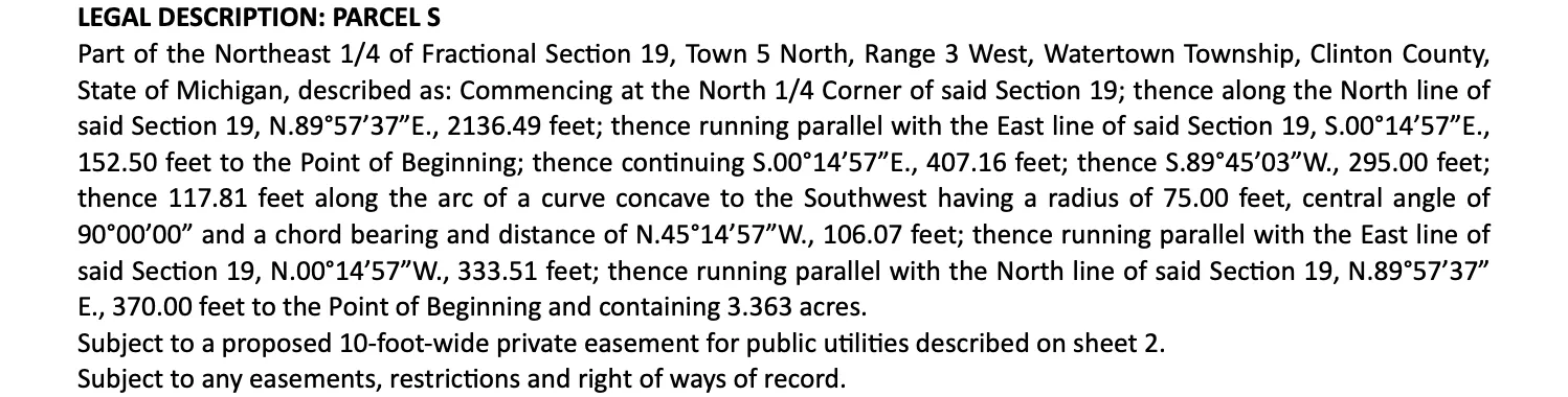
Not every leg is straight. A road frontage or a cul-de-sac gives you a curve, and a curve takes more than a direction and a distance to pin down. Parcel S on the same page has one:
thence 117.81 feet along the arc of a curve concave to the Southwest having a radius of 75.00 feet, central angle of 90°00’00” and a chord bearing and distance of N.45°14’57”W., 106.07 feet
A curve needs a radius, plus enough information to know how much of the circle the boundary follows. That can be an arc length, a chord with its own bearing, or a delta angle. It also needs a turn direction — left or right, sometimes written as concave to some direction.
The useful part is that these parameters are locked together by geometry. Any two of radius, arc, and delta give you the third. So when a deed states only a radius and a chord, the curve is still fully solvable — it just takes a step of trigonometry that is easy to fumble by hand.
The Math at the End
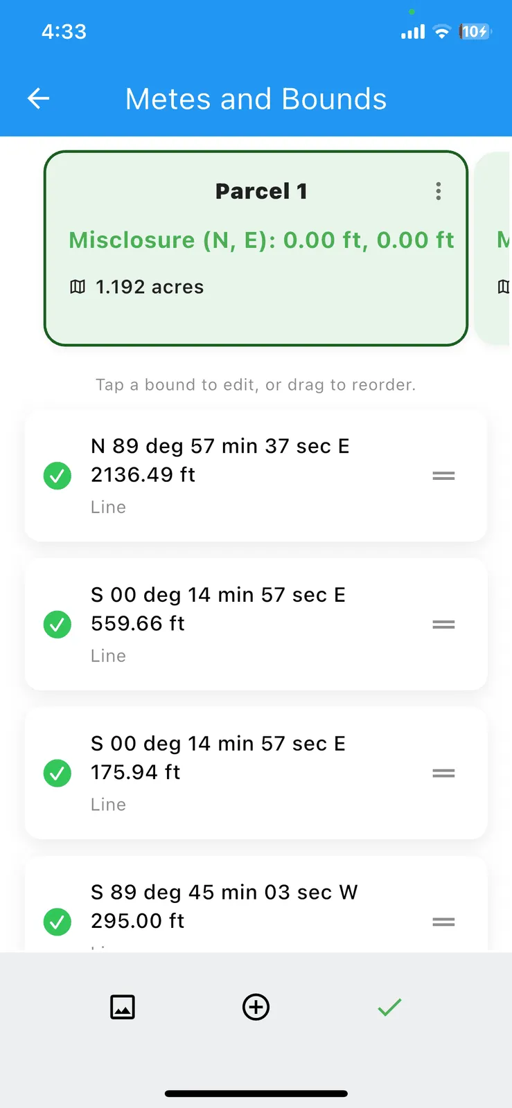
Once every call is read, you run the traverse: convert each leg into its north and east components and add them up in order. For a parcel, the walk should end exactly where it started.
The gap between where you actually land and the point of beginning is the misclosure. It is normally reported as a north value and an east value, and it is the single most useful number on the page.
- Near zero. The calls agree with each other. Good closure.
- A tenth or two. Usually rounding in the original description. Ordinary.
- A few feet or more. Something is wrong. A transposed digit, a flipped direction letter, a distance that read as 175.94 when the page says 776.94.
- Enormous. A whole call is missing, or a curve was read as a straight line.
Because it scales with the size of the parcel, misclosure is often reported as a precision ratio instead — the perimeter divided by the gap, written as something like 1:10,000.
Closure also gates the area. Acreage is computed from the plotted corners, so a description that does not close reports the wrong acreage too. A parcel that “looks about right” but misses closure by six feet is not a parcel you should be drafting against yet.
Reading Faster
None of this is difficult. It is just slow, and it is unforgiving: one wrong keystroke in the middle of forty calls, and the closure math fails without telling you which line caused it.
That is the entire reason EZBounds exists. Point it at the page, and it reads the calls, converts the units, solves the curves, runs the traverse, and reports closure and acreage before you have finished scrolling. What you review is the extracted text against the source document, not your own typing — and when it looks right, you export a DXF and start drafting.
Terms in this article
Every term this post uses, defined. Each one has its own page with more detail.
- acreage
- Parcel area in acres; one acre is 43,560 square feet.
- aliquot part
- A clean fractional division of a section, like the NE 1/4 of the SW 1/4.
- arc length
- The distance measured along the curve itself.
- azimuth
- A direction as a single angle from 0° to 360°, measured clockwise from north.
- bearing
- A direction measured from north or south, written like N 45°30′00″ E.
- call
- One leg of the boundary — a single bearing and distance, or a single curve.
- chain
- An old surveying unit: 66 feet, or 100 links.
- chord
- The straight line between the two ends of a curve.
- closure
- Whether the boundary comes back to its starting corner.
- concave
- Which side the curve’s center sits on — the direction it bends toward.
- curve
- A boundary leg that follows a circular arc instead of a straight line.
- deed
- The recorded document that transfers land, containing its legal description.
- degrees, minutes, seconds
- Angle notation: 1 degree = 60 minutes, 1 minute = 60 seconds.
- delta angle
- The angle the curve sweeps at the circle’s center.
- DXF
- A CAD drawing exchange format that opens in AutoCAD, Civil 3D, and the rest.
- legal description
- The written text in a deed that defines exactly which piece of land is conveyed.
- misclosure
- The gap between where the last call lands and the point of beginning.
- parcel
- A single defined piece of land — one closed boundary.
- PLSS
- The township-and-range grid that covers most of the western and central U.S.
- point of beginning
- The corner the description starts from — and must return to.
- precision ratio
- Misclosure compared to perimeter, written like 1:10,000.
- radius
- The distance from the center of the circle to the curve.
- rod
- 16.5 feet — a quarter of a chain. Also called a pole or perch.
- thence
- The word that separates one call from the next: "from there, continue…".
- traverse
- The chain of calls walked end-to-end to draw the boundary.
- vara
- A Spanish-colonial unit, about 33.33 inches in Texas.
Try It On This Post's Data
Capture, download, or open these specific examples to test the extraction.