Legal Descriptions, Simplified.
Instantly convert metes and bounds legal descriptions into accurate, CAD-ready DXF files. Save time, reduce errors, and streamline your workflow.
Powerful, Precise, and Professional
EZBounds transforms the tedious task of interpreting property descriptions. Simply take a picture or upload a PDF of your metes and bounds legal description. Our app automatically checks for misclosure, computes the enclosed area, and generates a DXF file ready for any CAD software.
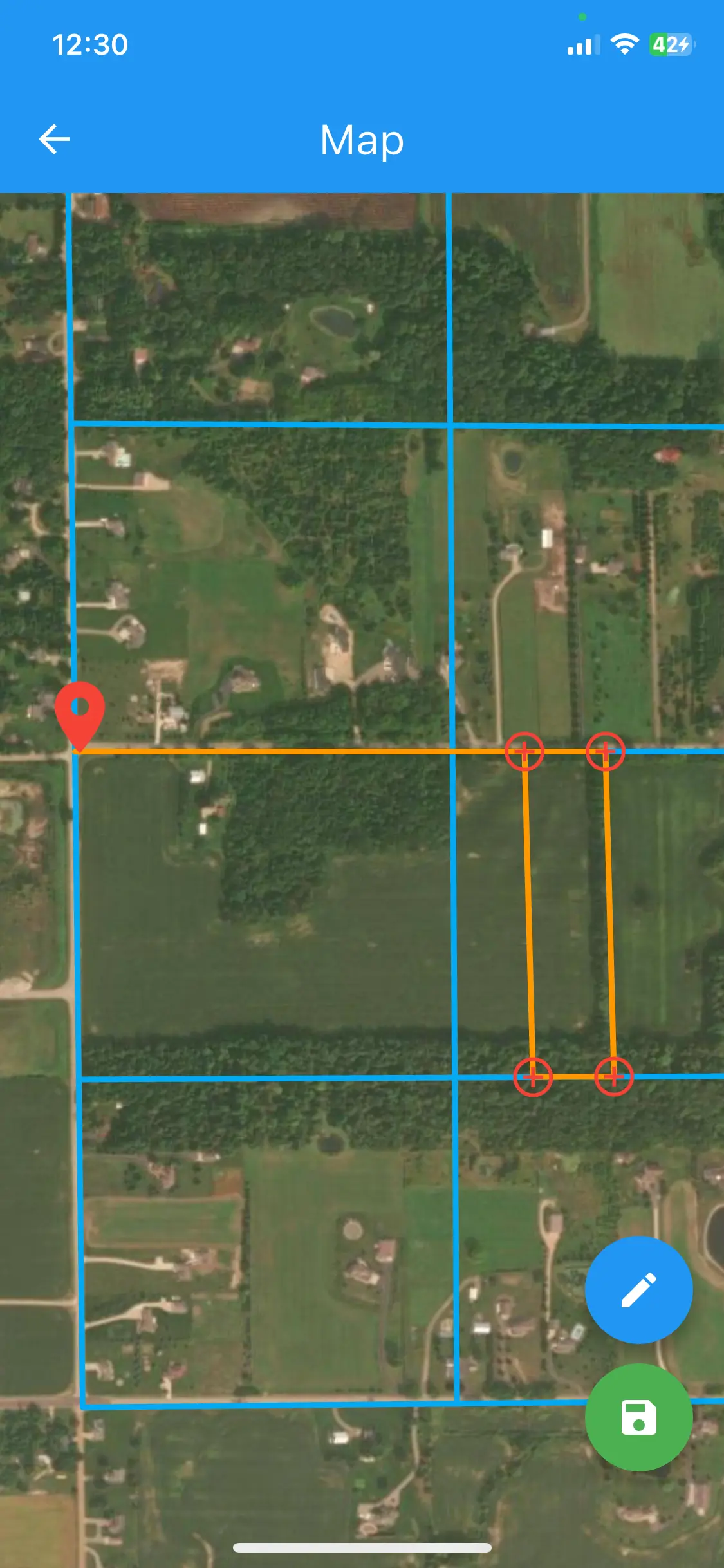
Easily Visualize Legal Descriptions
See your property boundaries come to life directly on a map. Instantly understand the layout and context of any legal description.
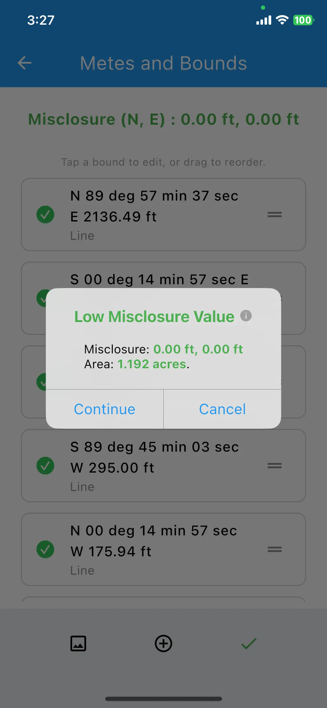
Verify Acreages and Check Misclosure
Ensure accuracy with automated misclosure checks and precise acreage calculations. Catch errors before they become costly.
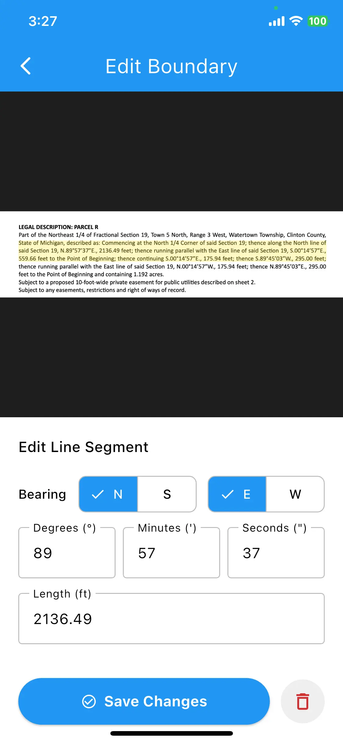
Full Control Over Project Details
Easily edit and refine boundary segments, ensuring every detail of your project is precise and up-to-date.
Tailored for Industry Professionals
EZBounds is the essential tool for anyone working with property legal descriptions.
Land Surveyors
Quickly verify legal descriptions and generate preliminary drawings on-site or in the office.
Civil Engineers
Integrate property boundaries seamlessly into your site plans and project designs.
Title Companies
Visualize and confirm property boundaries to ensure accuracy in title reports and insurance.
Planning Departments
Review and manage land parcels efficiently for zoning, permits, and public records.
Features That Make a Difference
Everything you need to work faster and smarter.
Image Recognition
Snap a photo of any legal description. Our powerful OCR technology does the rest.
Instant Analysis
Automatically get closure reports, area calculations, and error checking in seconds.
CAD-Ready Exports
Generate clean DXF files that import perfectly into AutoCAD, Civil 3D, and more.